|
OSM based maps for Garmin GPS devices
|
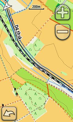
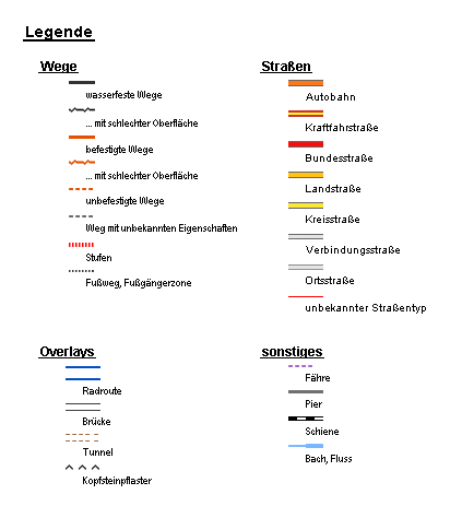
In addition to a coherent representation of the landscape that is part of a topographical map, you'll find in this map information about accommodation (hotel, hostel, bed&breakfasts, tent), various shops (especially bicycle shops), doctors, hospitals, restaurants and transport facilities. Also used to distinguish the way off the streets according to their composition and suitability for cycling with a trekking or touring bike. Cobblestones will be marked on any road. The maps were created from data of OpenStreetMap Installation as gmapsupp.img The maps are already available as gmapsupp.img and must be extracted to the subfolder ... \Garmin\. If possible, the map should be stored on an external memory card and not in the main memory of the GPS device. Installation for BaseCamp/MapSource For using the maps with BaseCamp or MapSource download the Setup and extract it to one of the Garmin Map directories, like C:\ProgramData\Garmin\Maps. The maps were tested by me. Every usage is on your own risk. Routing The routing is designed to travel on a bike. Any use by other modes is not intended and not even advisable. Good results are provided by the auto-routing if you set the routing mode to 'Auto / Motorcycle'. Highways should be allowed. The switch 'dirt roads' avoids the routing on trails, with 'toll' you can switch off usage of important roads. The route created by auto-routing represents only a proposal route and must be adapted to the situation.
|  |
Pictures offered on this page are licensed under CC-BY-SA 2.0
Maps for Garmin devices offered on this page are generated by data provided by OpenStreetMap and is licensed under ODbL.
Mkgmap-style is released under CC-BY 2.0


